
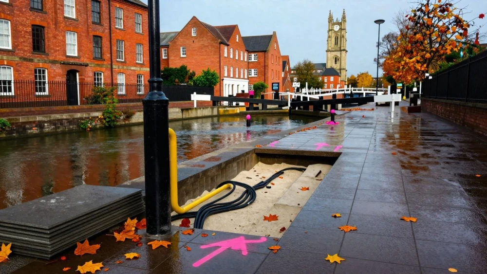
Utility Surveys
Get in TouchAt Leicester Surveys, we specialise in conducting utility surveys to accurately locate and map underground utilities. Our surveys are essential for identifying the positions of pipes, cables, and other subsurface assets to ensure safe and efficient excavation or construction work.
We use advanced techniques such as Ground Penetrating Radar (GPR) and electromagnetic detection to deliver detailed and reliable results. Our service includes detailed reports, marked plans, and digital maps tailored to your project's specific needs.
Contact us today to request a detailed consultation for your utility surveying needs.
How Much Does a Utility Survey Cost?
A utility survey typically costs between £500 and £1,500, depending on the size of the area and the complexity of existing utilities. Factors such as the depth and density of underground assets and the required detail in mapping can influence the final price.
For instance, surveys involving congested utility networks may require Ground Penetrating Radar (GPR) equipment for accurate mapping, which can affect costs. Additionally, the need for electromagnetic locators to detect non-conductive utilities like plastic pipes may also play a role.
Our team at Leicester Surveys adheres to PAS 128 standards, offering tailored solutions for diverse properties, from residential developments to commercial projects. We provide detailed quotes based on your specific requirements.
Contact us for an exact quote that caters to your project's needs.
How Are Utility Surveys Conducted?
At Leicester Surveys, we conduct utility surveys through a detailed process of mapping underground services.
Initial Assessment: We begin with a site visit to understand the specific requirements and assess the project's scope.
Data Collection: Using equipment like Ground Penetrating Radar (GPR) and electromagnetic locators, we gather accurate data about the subsurface utilities.
Data Analysis: The collected data is analysed to produce detailed reports, maps, and plans.
Reporting: We deliver a report, including digital maps and marked plans, to guide excavation or construction works safely.
How Long Does a Utility Survey Take?
The duration of a utility survey depends on the survey area and complexity of the utilities, typically ranging from one to four days. Factors such as soil type, underground congestion, and access to site-specific historical records can impact the timeframe.
For instance, a densely populated urban area with a tangle of utilities like water, gas, and fibre-optic cables may require more meticulous work than a less complex site.
We conduct utility surveys using methods like Ground Penetrating Radar (GPR) and Electro-Magnetic Location (EML), adhering to PAS 128 standards to ensure precise data collection. This includes identifying the position of utilities at various depths, helping to avoid costly damages during future excavation.
By coordinating with your project timeline, we minimise disruption and deliver reliable results.
Contact us today to schedule your utility survey.
What Are the Benefits of Utility Surveys?
Utility surveys offer numerous benefits, making them an essential part of planning and construction projects. By using ground-penetrating radar (GPR) and electromagnetic detection methods, we provide a detailed mapping of infrastructures such as water pipes, gas lines, and electrical conduits.
Accurate Mapping: Precise identification and location of underground utilities, crucial for urban development and land management.
Safety Assurance: Reduce the risk of accidents during excavation by identifying hazards like fibre-optic cables and pressurised gas lines.
Project Efficiency: Avoid project delays by knowing exactly what lies below the surface, complementing Building Information Modelling (BIM) processes.
Cost Savings: Minimise unexpected costs related to utility damage, aligning projects with budget planning and preventing disruption.
Get in touch with Leicester Surveys to enjoy the full benefits of professional utility surveys.
Speak to a Utility Surveys Expert
Why Choose Leicester Surveys for Utility Surveys?
Choosing Leicester Surveys for utility surveys ensures expertise, accuracy, and reliability in mapping underground assets. Our experienced surveyors use advanced tools such as Ground Penetrating Radar (GPR) and electromagnetic locators to identify utilities like gas pipelines, water mains, and electrical cables with precision.
We also undertake utility identification following PAS 128 standards, which help maintain consistency across projects and reduce the risk of expensive errors during construction.
Our services cater to a wide range of clients including construction companies, local councils, and utility providers. By integrating Computer-Aided Design (CAD) software, we can deliver clear, detailed maps that perfectly align with our clients' project specifications.
We tailor our services to meet specific project needs across various industries, ensuring the highest standards are met. Contact Leicester Surveys for a reliable and detailed utility survey service in .
Frequently Asked Questions
How Can I Book a Utility Survey with Leicester Surveys?
You can book a utility survey with us by contacting our team via phone or email to discuss your project requirements and schedule a site visit at your convenience.
What Is the Importance of Utility Surveys Before Construction?
Utility surveys are crucial before construction to prevent damage to underground assets, ensure project safety, and avoid costly delays.
Can Utility Surveys Detect All Underground Utilities?
We use techniques to effectively detect a wide range of underground utilities, but some limitations exist with non-conductive materials or very deep utilities.
Is There a Minimum Area Requirement for a Utility Survey?
No, there is no minimum area requirement. We tailor our services to accommodate areas of any size, from small plots to large construction sites.
Do Utility Surveys Cover Private Properties?
Yes, our utility surveys can cover both public and private properties, provided permission is arranged where necessary.
Get a Free Quote for Utility Surveys
Contact Leicester Surveys today to discuss your utility survey needs and obtain a free, no-obligation quote for your project.